Hiking in Malta: The Best Trails, Maps and GPX (2026)
12 min read

Malta is a good hiking destination from October to May. The classics are the Dingli Cliffs walk to Wied iż-Żurrieq, the Victoria Lines Trail along the island's central ridge, Marfa Ridge in the north and the Gozo coast. Most trails are short, exposed and reachable by bus, and every one below has a free GPX.
People tend to think of Malta as a beach-and-bars island, and in July they are right: the countryside bakes and nobody sensible walks in it at noon. From autumn on, the picture changes. The first rains turn the fields green, the cliffs empty out, and an island the size of a large city turns out to hold more walking than you could finish in a winter: sea cliffs rising more than 200 metres above the water, a British defensive wall that crosses the island, Knights-era towers on every headland and, a ferry ride away, a second island cut by gorges.
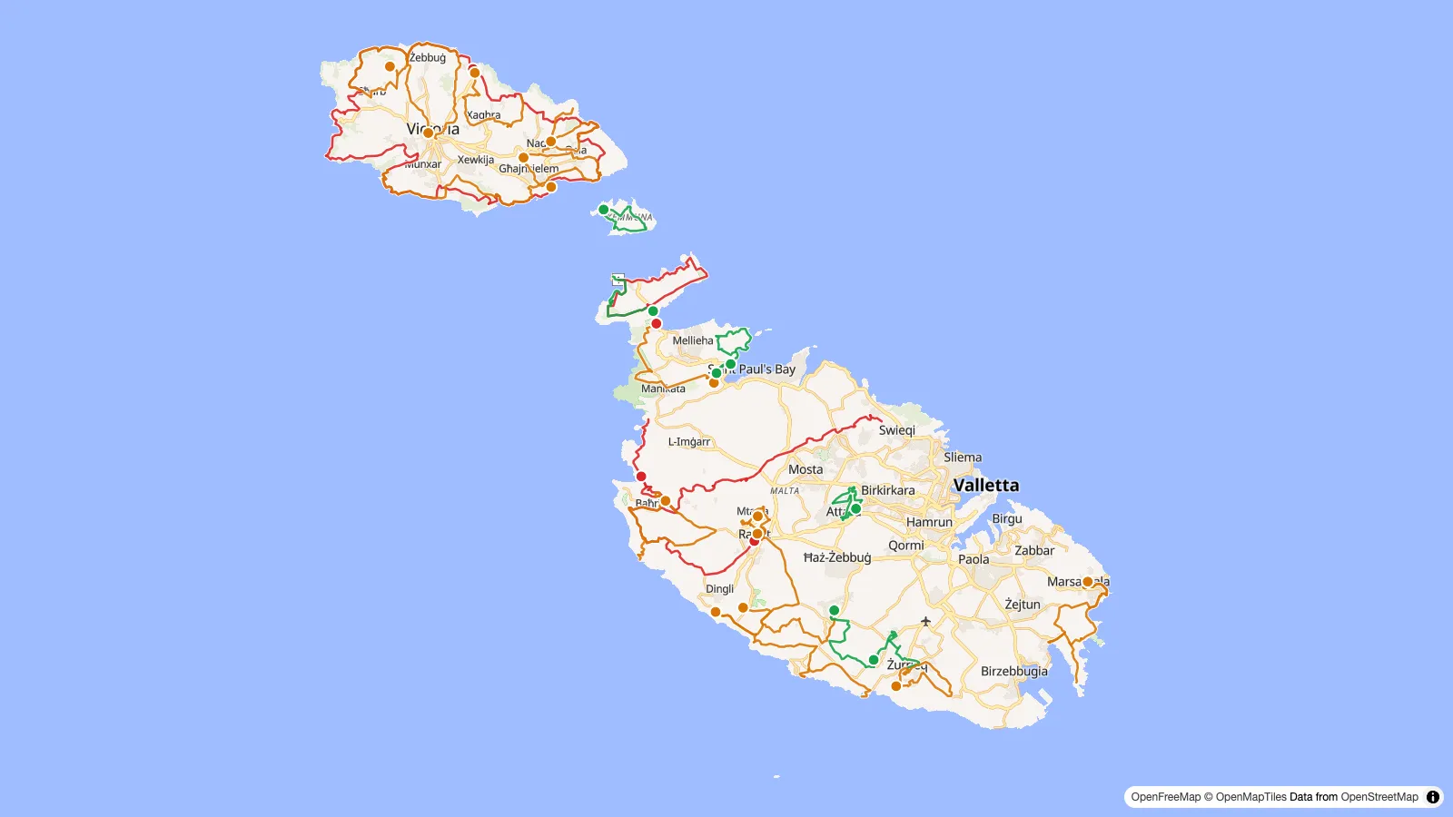
I have drawn every route in this guide on the Malta hiking map, with distance, climb and a downloadable GPX for each, so you can see the options before you pick one.
The best hikes in Malta at a glance
Distances are measured on the mapped route and the climb comes from a 25 m elevation model, so treat both as close estimates. "One way" walks need a bus back.
| Trail | Island | Distance | Climb | Type | Why go |
|---|---|---|---|---|---|
| Dingli Cliffs to Wied iż-Żurrieq | Malta | 11.9 km | ~180 m | One way | Highest cliffs, Bronze Age site, ends at the Blue Grotto |
| Victoria Lines Trail | Malta | 16 km | ~400 m | One way | British wall along the Great Fault, the longest walk on Malta |
| Watch Towers Walk (Marfa Ridge) | Malta | 14.5 km | ~190 m | Loop | Sea on both sides, views to Comino and Gozo |
| Baħrija Walk | Malta | 12.9 km | ~290 m | Loop | Wild west coast, rough paths, few people |
| Girgenti Walk | Malta | 8 km | ~70 m | One way | Cart ruts, cave dwellings, Buskett woodland |
| Tas-Silġ Walk via Delimara | Malta | 9.2 km | ~120 m | One way | Coastal path past St Peter's Pool |
| Xlendi Walk | Gozo | 12 km | ~350 m | One way | Ta' Ċenċ cliffs and Mġarr ix-Xini |
| Ta' Ġurdan Walk | Gozo | 9.6 km | ~160 m | Loop | Sea caves, Wied il-Għasri gorge, the lighthouse |
| Gozo Coastal Walk | Gozo | 49.8 km | ~1,060 m | Loop | The whole island in three or four days |
| Comino Walk | Comino | 5.8 km | ~90 m | Loop | Car-free island, Santa Marija Tower |
Malta's classic walks, region by region
The south-west cliffs: Dingli, Girgenti and the Maqluba
This is where to start. The Dingli Cliffs are the highest ground on Malta, a sheer drop to the sea with the islet of Filfla offshore, and the official Visit Malta walk from the cliffs to Wied iż-Żurrieq strings together the best of the south coast. It leaves from the Dingli Cliffs interpretation centre, passes the tiny St Mary Magdalene Chapel on the cliff edge, detours onto a headland with a Bronze Age village site, then drops through the farmed Fawwara area towards the Ħaġar Qim and Mnajdra temples before ending at the creek where the Blue Grotto boats leave. Much of it is on quiet country roads rather than trail, which makes it an easy first hike. According to the Visit Malta leaflet, bus 52 serves the cliffs and route 201 runs along the coast for the way back, but numbers change, so check Malta Public Transport before you set off.
Inland, the Girgenti Walk starts at the edge of Buskett, the closest thing Malta has to a forest, crosses the plateau of prehistoric cart ruts known as Clapham Junction and passes the Għar il-Kbir caves, which were lived in until the 19th century. It ends in Siġġiewi's main square after the Laferla Cross viewpoint. The Mdina to Dingli Cliffs walk links Malta's old capital to the same cliffs on country roads, and the short Maqluba Walk from Siġġiewi to Qrendi ends at the rim of Il-Maqluba, a sinkhole that collapsed in a storm in 1343.
The Victoria Lines: Malta's ridge walk
The Victoria Lines are a chain of walls, batteries and forts the British built between 1875 and 1899 along the Great Fault, the escarpment that splits Malta into a higher north and the rest of the island. They were decommissioned in 1907 without ever being attacked. Today they make the most varied walk on Malta: ridge paths beside the wall, the Binġemma and Falka gaps, Fort Madliena at the eastern end and big views over the northern valleys.
Set your expectations before you go. The trail is 16 km on the mapped route with about 400 m of climb, and it is not a finished national trail. Since 2022, Ambjent Malta, the Ramblers and the Friends of the Victoria Lines Trail have been clearing paths and adding signs and benches, but waymarking is still patchy, the wall is largely missing between Naxxar and Mosta, and there is a real gap with no formal crossing where the route meets Triq l-Imġarr. The simplest plan is to walk it in two halves, split between Mosta and Naxxar where buses link the sections, and to carry the GPX. There is no shade on the ridge and nothing to buy along it.
The north: Marfa Ridge, Selmun and Xemxija
Malta's northern tip is a narrow limestone ridge with the sea on both sides. The Watch Towers Walk loops from Għadira Bay up onto Marfa Ridge beneath St Agatha's Tower, the red tower the Knights built in 1649, with Comino and Gozo in front of you most of the way. If you would rather walk one way to the Gozo ferry, the route from Mellieħa Bay to Ċirkewwa covers the same ridge in 5.6 km and ends near Paradise Bay.
Further east, the Xemxija, Mistra and Selmun loop takes rough paths over the Selmun peninsula past Mistra Bay and Fort Campbell, looking out at St Paul's Islands. Right above Xemxija, the Xemxija Heritage Trail is a short, signposted 1.7 km climb along an old road with Punic tombs, cave dwellings, Roman baths and a Roman apiary, a good hour if you are staying in the north and do not want a full day.
The west coast: Baħrija, Fomm ir-Riħ and Golden Bay
The west is the emptiest part of Malta, and the Baħrija Walk is the rough one: stream beds, rubble paths and exposed cliff tops, graded "challenging" by Visit Malta. It loops from il-Fiddien through Baħrija, past a Bronze Age site at il-Qlejgħa, with an optional detour to the Miġra l-Ferħa cliffs. There are no shops or bars once you leave Baħrija's square, so carry water. The longest route here, Rabat to Golden Bay (17.6 km), heads out of Rabat on country roads, crosses the high ground above Fomm ir-Riħ and finishes on a rocky coastal path via Ġnejna Bay. The last section has steep, loose stretches, and you finish at a beach with a bus back to Valletta.
The south-east: Marsaskala to Marsaxlokk
Two versions of the Visit Malta Tas-Silġ Walk link Marsaskala and Marsaxlokk. The short one (7 km) heads inland past the Tas-Silġ archaeological site. The longer one (9.2 km) keeps to the coast, along the Munxar cliffs and around the Delimara peninsula past St Peter's Pool and the lighthouse, before dropping into Marsaxlokk in time for the fish restaurants. A 2025 comment on one walking guide reports that parts of the wider route are now fenced as private property, so be ready for a detour.
Village walks for a flat afternoon
Not every walk has to be a hike. The official Three Villages Walk links Attard, Lija and Balzan past San Anton Palace and Villa Bologna, the British Military Walk loops from Mdina through Mtarfa's old barracks and military hospital, and the Windmills Walk in Żurrieq and Safi passes four windmills and the 16th-century Bubaqra Tower. They are mostly on streets, with cafés on the way, and they work on a hot day when the cliffs do not.
Hiking in Gozo and Comino
Gozo is greener, emptier and steeper than Malta, and for many walkers it is the reason to come. The tourism authority publishes a set of official walks as VisitGozo booklets, and they are the backbone of the Gozo side of the map.
The Xlendi Walk is the one I would pick first. It runs 12 km from Mġarr Harbour, where the ferry lands, along the low coast to the inlet of Mġarr ix-Xini and its Knights' tower, then climbs onto the Ta' Ċenċ cliffs above Sannat and drops through Munxar to Xlendi Bay. It has about 350 m of climbing and a long clifftop stretch. The Ta' Ġurdan Walk loops from Għarb past the 15th-century San Dimitri chapel, down to the sea caves at Wied il-Mielaħ and along to the Wied il-Għasri gorge, before climbing to the lighthouse and passing Ta' Pinu on the way back. On the north coast, the Salt Pans Walk loops from Victoria to the salt pans at Xwejni and Qbajjar, and the Ramla Walk goes from Marsalforn through Xagħra, past the Ġgantija temples, to the red sand of Ramla Bay.
In the east, the Ħondoq ir-Rummien Walk loops from the ferry terminal up to the Qala belvedere over Comino and down to Ħondoq bay, the place for a swim. The Daħlet Qorrot Walk starts in Nadur, crosses the plateau to the Ta' Sopu watchtower and drops to a small bay where fishermen have cut their boathouses into the rock.
The Gozo Coastal Walk ties it all together: the full loop around the island, 49.8 km on the mapped route, usually walked in three or four stages that each end somewhere with a bus. It is only partly marked, with red dots in places, and several stretches have no clear path, so this is the route where the GPX really earns its place. If you are thinking about more than a visit, my guide to living in Gozo covers what the island is like the rest of the year, and getting around Gozo explains the buses you will use to reach the trailheads.
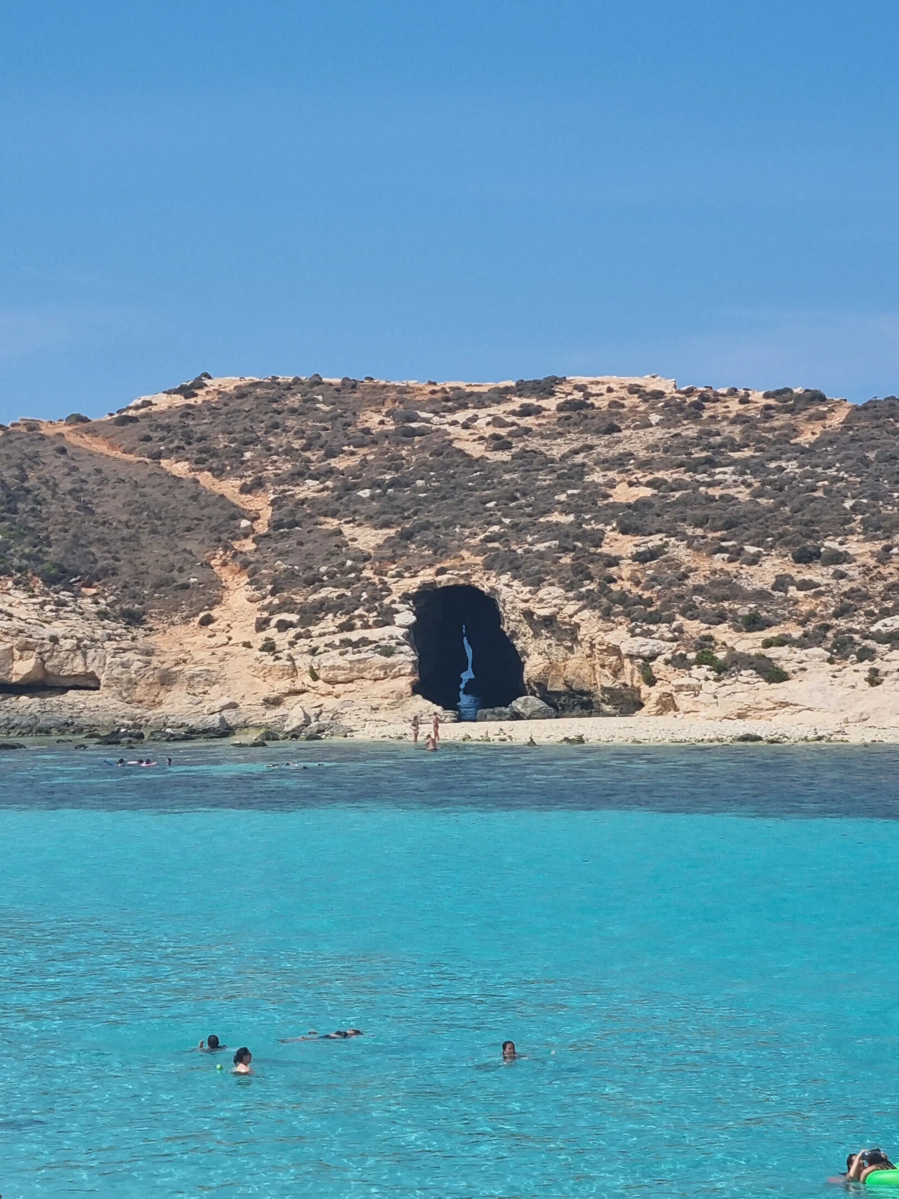
Comino has no cars, and the Comino Walk loops 5.8 km from the Blue Lagoon past the Crystal Lagoon to Santa Marija Tower (1618), the Santa Marija Battery and the old isolation hospital. There is no shade and nothing to buy outside the lagoon kiosks, so carry all your water, and take the first boat: my Blue Lagoon guide explains the free visitor pass and why you can walk straight through without one.
When to hike in Malta
October to May is the season. Summer temperatures can pass 35°C, and on an island with almost no trees, an exposed cliff walk at noon in August is dangerous rather than just uncomfortable. If you have to walk in summer, start at first light, stick to short coastal routes and be off the trail by mid-morning.
Autumn and winter are pleasant walking weather. From February the fields fill with wildflowers, which makes March and April the best months of the year for most people. Rain is not usually a problem, with one exception: after a heavy downpour, the valleys (widien) can flood fast, and the Gozo booklets warn you to stay out of them during and just after a storm. Clay paths turn slippery for a day or two after rain.
Hunting season, RTO signs and private land
Two things surprise hikers in Malta, and neither is dangerous if you know about them.
Hunting. Bird hunting and trapping are legal in season, and they take place in exactly the countryside you will be walking through. The autumn season ran from 1 September 2025 to 31 January 2026, and the spring season from 13 April to 3 May 2026, with shooting allowed from two hours before sunrise until noon in spring, as reported by the Malta Independent. The VisitGozo booklets note that shooting is banned from 1pm on Sundays and public holidays. In practice you will hear shots and pass hides. Stay on the path, keep a friendly distance and walk on.
RTO signs. "RTO" means Reserved to Owner: the land is private. You will see it painted on rocks, gates and walls along many walks, sometimes on land where the claim is dubious. Do not argue about it on the spot. Stay on the public track, do not cut across fields or climb over rubble walls, and if a path is blocked, take the detour. Walkers' groups, including the Ramblers' Association of Malta, campaign for access to the countryside, and that is the place for the argument.
Add the usual precautions for a limestone coast. Keep well back from cliff edges, especially in wind: the rock is undercut, the edges crumble, and nothing is fenced. Wear real shoes, because garrigue is sharp and the paths are loose rubble.
Getting to the trailheads
You do not need a car. Almost every walk in this guide starts or ends in a village, a bay or a ferry harbour with a bus stop, and the one-way walks are designed around that: you take a bus out and another back. Route numbers change, so check each trip on Malta Public Transport the day before rather than trusting a leaflet. For Gozo, the ferry from Ċirkewwa lands at Mġarr, where several of the walks start; the Malta and Gozo transport guide covers the ferries and the bus network.
GPX, apps and waymarking
Waymarking in Malta ranges from good (the Visit Malta walks have coloured signs in the countryside) to missing (much of the Gozo coast and the Victoria Lines). A GPX on your phone is the reliable answer. Every trail on the hiking map has one, generated from the OpenStreetMap route. Tap a line, hit Download GPX and open it in Komoot, Wikiloc, Gaia, OsmAnd or your watch. AllTrails, Komoot and Wikiloc also carry community routes for Malta, useful to read recent reviews of a path's condition.
Carry more water than you think you need, since most routes have nowhere to refill between villages, plus sun protection even in winter. Mobile coverage is good almost everywhere, with a few dead spots on the west coast around Baħrija.
Where to go next
If you finish a coastal walk hot and dusty, the beaches map shows every swimming spot on the coast, and the guide to Malta's best beaches covers the ones worth a detour. For everything else to do between hikes, the things to do map has the viewpoints, historical sites and day trips.
Written byVincent Ventalon
French software engineer living in St Julian's and running his company from Malta. This site is what I learned on the way.More about me